
It's pretty safe to say that Montana is known for its natural beauty. It's a pretty big state. But, you can't drive too far without running into some type of natural area. Big Sky Country boasts 20 national and state forests and 55 state parks. And, you can't forget two of the most well-known national parks in the system: Yellowstone and Glacier.
Needless to say, there is no shortage of natural beauty to explore in Montana. Whether it's a stay next to a pristine lake or a challenging mountain hike, we've got the state's top 8 backpacking trails listed below. So, grab your favorite drink, read on, and start planning your next adventure!
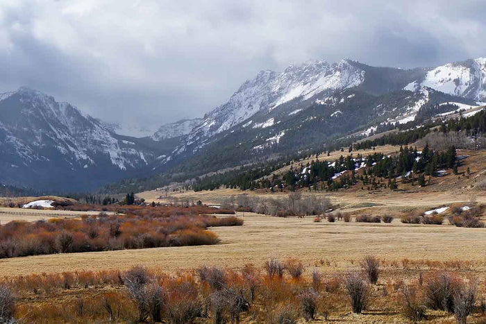
Featured Photo: Crazy Mountain (photo by Troy Smith)
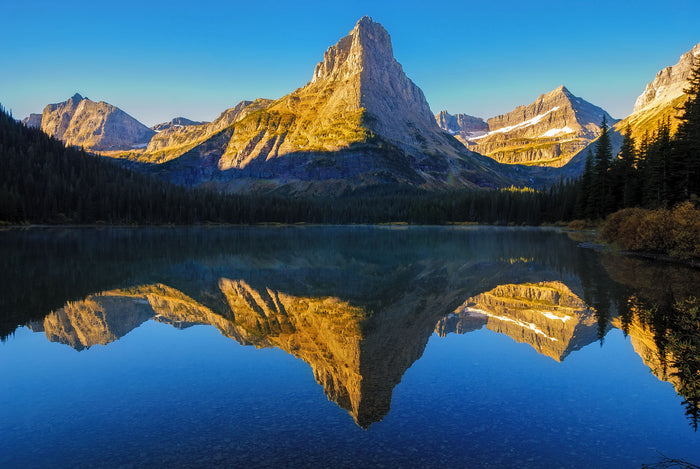
Glacier North Circle
Glacier National Park is a top bucket list trip for many people. If you want to see the best the backcountry there has to offer, take the Glacier North Circle. You'll find stunning views along the Continental Divide on the 11-mile Highline Trail. Other highlights include the Ptarmigan Tunnel, Stoney Indian Pass, and Swiftcurrent Pass. And, of course, there are glaciers galore, alpine lakes, waterfalls, and bountiful wildflowers.
The entire trail is 52 miles long. Plan on taking a week to really enjoy it. There are lots of Grizzlies in the area. Be very sure that you're prepared and know what to do if you encounter a bear. You will definitely want to get your permits ASAP. Read our full write-up for all of the details.
Johnson Lake Loop
There are several ways to get to Johnson Lake. Most range between 13 and 17 miles, making it a good overnight option. Or, take several days to really enjoy it. This 15-mile route has an elevation gain of 2,700ft. You'll find beautiful wildflowers and waterfalls along the way. Pintler Pass is another highlight. Johnson Lake has established campsites. (You're required to stay at these.) Backcountry anglers will want to take their fishing gear. Beware, though. The mosquitos can be pretty bad in warm months!
Cottonwood Lake Trail-Crazy Mountains
Don't let the short distance of this trail fool you. This 10-mile out-and-back is rated moderate to challenging and has an elevation gain of 2,300 feet. Be prepared for lots of creek crossings. Some water shoes might be a good idea. You'll know you're getting close to the lake when the trail really starts getting steep. The views are more than worth it, though.
Make sure to take your fishing pole for this one too. Or, your bathing suit if you want a brisk dip in the lake. It's worth noting that the road in is subject to seasonal road closures. Be sure to check before heading out.
The Beaten Path
The 26-mile Beaten Path trail is an excellent option if you want to see the stunning scenery Montana has to offer, but get away from the larger crowds like at Yellowstone. This point-to-point located in the Absaroka-Beartooth Wilderness will require a shuttle. Dispersed camping is allowed, but you'll probably want to enjoy one of the designated spots next to one of the many lakes. There are at least 16 along the way, making it another great trail for backcountry fishermen.
The trail can be busy in parts with day hikers. But, the views and solitude further in are worth it. You'll also love the waterfalls along the route. Side trails give you opportunities to extend your adventure. Get all of the details in our full blog post.
Overwhich Falls
If you haven't gathered by now, there is no shortage of waterfalls in Montana. Overwhich Falls is the main highlight of this 16.5-mile out-and-back trail. Located in the Bitterroot National Forest, you can expect about 2,600ft of elevation gain. It meanders along Warm Springs Creek, so you're never far from a water source.
Talus at the beginning gives way to forest, which gives way to a meadow that's sure to have plentiful wildflowers in the late spring. After that, it's back to shady woods full of towering trees. Next up are a few creek crossings and a steep ascent as you get closer to the falls. Some people like to continue on to Pass and Capri Lakes. Keep in mind this trail is shared with horseback riders.
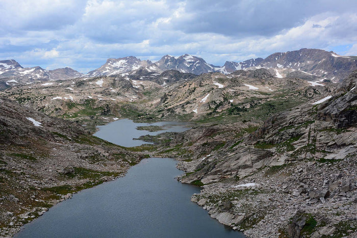
Wanless Lake Trail
The 19.5-mile route to Wanless Lake features a hefty 4,7800 feet of elevation gain. Depending on who you ask, it's rated moderate to difficult. As usual, take ratings with a grain of salt and read some trail reports. Only you know what you can handle. It's a rather zig-zagged ascent, too, which should help some with the climb.
There are plenty of things to take your mind off the ascent along the way. You'll pass several smaller lakes with calm, clear water before you even reach Wanless Lake. Once there, there's also a little waterfall trickling over the granite slab that boxes it in. Several peaks along the way will catch your eye, including talus-covered Goat Peak and Engle Peak. And, the stunning valley views can't be beat.
Sky Rim Loop
It's hard to choose what area of Yellowstone to explore. If you have time, you'll likely want to see as much as you can! If you have a few nights and want to get away from the crowds of the more popular sights, we suggest the Sky Rim Loop.
This lollipop loop trail takes you 20 miles through some of the most memorable terrain the park has to offer. One of the highlights includes a 7-mile walk along the Gallatin Range, affording views of the nearby Absaroka and Madison mountain ranges. While you're at it, you may as well take the short side trail to Big Horn Peak too. For all of the details on this trail, head over to our full write-up.
Edith Baldy Basin Trail
Like many of the hikes on this list, there are several different ways to get to this place. Routes range from a short 3-mile day hike to a 20-mile out-and-back. Some will take you to the peaks themselves. (Mt. Edith and Mt. Baldy) The latter will get you close enough for great views of both!
There are several creek crossings as you near Mt. Baldy. So, be prepared for those, which could be trickier in the earlier months of the season. Nearby lakes make great rest stops. Don't forget your camera to capture all of the colorful wildflowers. And, if that's not enough, the expansive views won't disappoint.
Location Map
The following map shows the location of each trailhead for your reference. Click the "Load Interactive Map" button to load the correct map. Once loaded, you can navigate to each trailhead and see the various trails.
For even more detailed mapping, including being able to print a copy for yourself, click the "Open in CalTopo" button at the top of the map once it's loaded into view.
Conclusion
Whether you're looking for a short, family-friendly hike or a week-long epic adventure, you're sure to find a scenic trail that won't disappoint! What are your favorite trails in Montana? We'd love to hear about them in the comments section below!
Read Next
If you're looking for more hike ideas, read our “Best Backpacking Trips in the Rocky Mountains” round-up post. Also, the following Hike of the Week articles cover other great trails in the region.
Hike of the Week: Teton Crest Trail
Hike of the Week: Titcomb Basin
Hike of the Week: Alice-Toxaway Loop
For even more amazing backpacking trips, visit The Trailhead, our interactive hike map. It contains a curated list of dozens of hikes, each with a detailed write-up like this one.

Finally, check out our comprehensive list of backpacking articles that cover just about everything there is to know about backpacking. If you're just starting out, our Backpacking 101 section covers all the basics. If you already have a few trips under your belt, you can find more advanced topics covered in our Expert Articles.


Leave a comment