
Welcome to Paria's “Hike of the Week” series. Each week, we highlight an outstanding backpacking trip from around the world. Our goal is to inspire you to get out and see these places for yourself. For us, just seeing amazing photos and reading about a great hike are enough to get us motivated!
This week's hike is the Rae Lakes Loop in California's Sequoia and King's Canyon National Parks.
Why This Hike?
The John Muir Trail through the Sierra Nevada is one of the top trails in the country. It features high alpine lakes, glacier-carved valleys, and gorgeous waterfalls. But, it takes at least two weeks to complete. For a shorter option, the Rae Lakes Loop lets you see some of the John Muir Trail highlights in less than a week.
- Distance: 42 miles
- Type: Loop
- Difficulty: Strenuous
- Elevation gain: 7,500 feet+
- Best time to visit: Early June-September
- Highlights: Glen Pass, Rae Lakes, Painted Lady, Mist Falls, South Fork Kings River, Dollar Lake, Arrowhead Lake, Vidette Meadows
- Wildlife: Marmots, pika, foxes, deer, bears, rattlesnakes
- Trail conditions are usually good. Plenty of access to water and campsites.
- For adventurous types, plan to visit the Sixty Lakes Basin area west of Rae Lakes and spend a night there. There are plenty of other side trails to explore too.
- For a gradual climb, travel clockwise. To tackle the strenuous part while you're still fresh, head counterclockwise.
Before you pack your bags, keep the following in mind:
- There are bears in the area, so practice bear safety at all times. Bear canisters are required anyway.
- Be sure to check for road closures before your visit. It's also worth inquiring about stream levels and whether Glen Pass is passable in springtime.
- Be prepared for afternoon thunderstorms.
- Be sure to check other restrictions on the National Park Service page. It's listed in the Resources section below.
How Do I Get There?
The trail is most accessible by flying into Fresno. But, the major airports near Los Angeles and San Francisco provide more route options.
From Fresno, take Highway 180 east toward Kings Canyon and continue for a tad over 90 miles to the Roads End Permit Station. A $20 per vehicle entrance fee will be required at the Kings Canyon National Park entrance. On your way out, make sure to stop and check out the giant Sequoia trees.
No shuttle providers are servicing the trailhead, so you will need a vehicle.
Map of Recommended Route
The following map outlines our recommended route. Click the "Load Interactive Map" button to load the correct map. Once loaded, you can navigate along the route and view recommended campsites.
For even more detailed mapping, including being able to print a copy for yourself, click the "Open in CalTopo" button at the top of the map once it's loaded into view.
The loop starts and ends at the Roads End Permit Station and runs approximately 42 miles. We recommend 5-6 days to really enjoy the trail. Our itinerary follows a counterclockwise route. This way, you can get the hard climb to Glen Pass out of the way near the beginning of your trip.
- Day 1 - Roads End Parking Area to Junction Meadow (11 miles)
- Day 2 - Junction Meadow to Glen Pass Base (5 miles)
- Day 3 - Glen Pass Base to Dollar Lake (4 miles)
- Day 4 - Dollar Lake to Upper Paradise Valley (9 miles)
- Day 5 - Upper Paradise Valley to Roads End Parking Area (9 miles)
Trail Description
Day 1 - Roads End to Junction Meadow
The first two miles are surprisingly easy and flat. Make a right at the junction onto Bubbs Creek Trail. You'll cross a bridge and find a water crossing around mile 3. How easy or difficult it is will depend on the snowfall over winter. Next is your first set of switchbacks as you start climbing.
You'll come across several campsites along the way. The trail switches between woods and open areas. But, the latter affords nice views of the mountains.
Day 2 - Junction Meadow to Glen Pass Base
Make sure you fill up on water from the creek before starting. You have a lot of uphill hiking to do! The beginning isn't too bad, in and out of the woods again. You'll get higher and higher as you reach the John Muir Trail. You'll also find another set of switchbacks. Take some much-deserved breaks to enjoy the awesome views today offers.
Day 3 - Glen Pass Base to Dollar Lake
It's wise to start early today. Afternoon thunderstorms are very common in the summer. More amazing views await, both on the way up and at the top of Glen Pass. Take some time to enjoy the 360° views of the surrounding mountains and lakes before heading down the other side. Be careful on the loose rocks.
Eventually, you'll get some magnificent views of Rae Lakes with lots of others along the way. Past there, the trail levels out some on the way to Dollar Lake.
Day 4 - Dollar Lake to Upper Paradise Valley
Today will feel like a walk in the park after the past two days. You might be relieved to know that it's mostly downhill. Perhaps the most exciting part of the day is the single-person bridge crossing Woods Creek. After that, you'll get a few nice views on the way down. But, nothing like the first few days.
There is another water crossing as you near Upper Paradise Valley. This one does not have a bridge. Be sure to bring some water shoes.
Day 5 - Upper Paradise Valley to Roads End
Although it's one of the longer days, the trail back to your car isn't too bad. You're traveling through a valley and headed downhill still. Plus, this gives you some pretty views of the mountains when you're out of the trees.
Be sure to plan a break at Mist Falls. You'll likely run into a lot of day hikers in this area. From here, it's a little less than four miles to the parking area.
What Will I Need?
The trail is well maintained and the conditions are excellent. The weather is generally very good from July through September. Average highs range from 71 to 79°F. Average lows range between 45 and 53°F. That said, make sure you have a sleeping bag or down quilt that will keep you warm at night. (An appropriately rated sleeping pad will help too!)
You'll also want a tent that's nice and light to save on pack weight. A pair of foldable trekking poles will come in handy. To save your breath at the higher altitude, pack a pump bag or a portable battery-powered air pump.
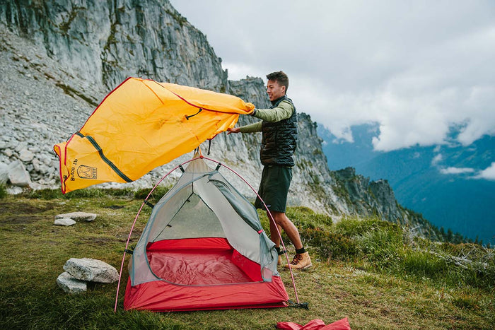
Our Bryce 1P backpacking tent is lightweight and weatherproof, making it the ideal option for the Rae Lakes Loop.
The National Park Service requires all hikers to carry portable bear-resistant canisters. You can find these many places, including REI and Amazon.com. If you forget, nearby US Forest Service offices also stock some.
If there's anything else you need to complete your pack, visit our full line of high-quality, affordable backpacking gear.
Shop Backpacking Tents
Shop Ultralight Tarps
Shop Backpacking Quilts
Shop Down Sleeping Bags
Shop Insulated Sleeping Pads
Shop Backpacking Pillow
Shop Folding Trekking Poles
Shop Titanium Cookware
Shop Tent and Tarp Accessories
Finally, to make sure you don't forget something at home, use our Ultimate Backpacker's Packing List. It even includes a convenient printable checklist!
Do I Need a Permit?
Permits are required. It's highly recommended to make reservations ahead of time for peak summer months. Reservations can be made on the National Park Service website starting on March 1st each year.
You will also need a national park entrance pass. The trail begins in Kings Canyon NP. To streamline things, you can get a 7-day pass in advance online.
Resources
Here are a few great resources to check out for more detail:
National Park Service
Modern Hiker
Backpackers Review
Conclusion
Have you hiked the Rae Lakes area? Do you have other outstanding hikes that you'd like us to write about? Let us know in the comments below!
Read Next
If you're looking for more hike ideas, read our “Best Backpacking Hikes in Sequoia National Forest” round-up post. Also, the following Hike of the Week articles cover other great trails in the region.
Hike of the Week: Trans-Catalina Trail
Hike of the Week: Onion Valley to Mt.Whitney
Hike of the Week: Thousand Island Lake Loop
For even more amazing backpacking trips, visit The Trailhead, our interactive hike map. It contains a curated list of dozens of hikes, each with a detailed write-up like this one.

Finally, check out our comprehensive list of backpacking articles that cover just about everything there is to know about backpacking. If you're just starting out, our Backpacking 101 section covers all the basics. If you already have a few trips under your belt, you can find more advanced topics covered in our Expert Articles.


Leave a comment