
This is a weekly series that highlights an outstanding day hike or backpacking trip. The goal is to inspire you to want to get out and see these places for yourself. I know for us, just seeing amazing photos and reading about a great hike is enough to get us motivated.
This week's hike is the Maroon Bells / Four Pass Loop in Colorado's Rocky Mountains.
Featured Photo: Maroon Bells (photo by John B. Kalla)
Why This Hike?
The Maroon Bells Loop provides an intimate, close up view of the Maroon Bells and other peaks in the Elk Mountain Range. Add in challenging river crossings in early summer, a sea of wildflowers in mid-summer, and golden aspens in the fall, and you have an epic adventure waiting for you any time of year!
- Distance: 27 miles
- Type: Loop
- Difficulty: Strenuous
- Elevation gain: 7,700 feet
- Best time to visit: July-September
- Plan on taking 3-4 days for this trip.
- There are side trip options to Geneva Lake and Willow Pass.
- The scenery includes beautiful wildflower meadows, verdant forests, and pristine lakes.
- Some of the main features include 4 high elevation passes: Buckskin, Trail Rider, Frigid Air, and West Maroon.
- Because of the high elevation, it's a good idea to come a day or two early to get acclimated.
Before you pack your bags, keep the following in mind:
- Challenging, steep switchbacks
- Afternoon thunderstorms can make for dangerous situations if you're hiking over one of the passes.
- Stream crossings are usually more difficult the earlier in the season you go.
- A bear-proof food storage container is a must.
How Do I Get There?
Maroon Lake is located only 10 miles southwest of Aspen, about 3.5 hours west of Denver, Colorado. If you're traveling from out of town, it's best to fly into Denver International Airport, rent a vehicle, and drive west on Interstate 70 and south on State Route 82 to Aspen.
From Aspen, drive west on State Route 82 for approximately 1/2 mile and then turn south on Maroon Creek Road. Proceed for about 9.5 miles to Maroon Lake.
From mid-June to early October, Maroon Lake is only accessible via a public bus between 8:00 a.m. and 5:00 p.m., unless you grab an overnight pass from the Forest Service Entrance Station along Maroon Creek Road. There is also a shuttle from downtown Aspen to Maroon Lake operated by the Roaring Fork Transportation Authority.
Map
The following map outlines our recommended route.
Click the "Load Interactive Map" button to load the correct map. Once loaded, you can navigate along the route and view recommended campsites.
For even more detailed mapping, including being able to print a copy for yourself, click the "Open in CalTopo" button at the top of the map once it's loaded into view.
Trail Description
Day 1 - Maroon Lake Trailhead to West Maroon Pass
Your trek begins with a less than 2-mile hike to Crater Lake through evergreen and aspen forests. There are lots of campsites around the lake. Then you'll continue on the somewhat gradual climb to West Maroon Pass. The trail sticks close to West Maroon Creek for a bit. Pass through stunning wildflower meadows before climbing the pass. Visit in mid-summer for peak flower season.
Day 2 - West Maroon Pass to Crystal River
If you choose not to campout near the pass, it's about a mile to the top with lots of steep switchbacks. After another sharp 1-mile drop, you'll come to the Frigid Air Pass intersection. After more switchbacks up, you'll head down toward Fravert Basin. Pass through more alpine meadows and spruce forest. You'll find your campsite (and others) near the Crystal River.
Day 3 - Crystal River to Snowmass Lake
Get ready to start your day with more steep switchbacks. But hey, there's a nice waterfall as a reward. After a few forks in the trail, you'll start climbing toward Trail Rider Pass. But first, pass by Geneva Lake (and maybe take a break). From the top of your third pass, you'll see Snowmass Lake, your next resting spot. The views on the way down to it won't disappoint!
Day 4 - Snowmass Lake to Maroon Lake Trailhead
You'll begin your last day by crossing over Snowmass Creek. From there, you'll start your climb to the final pass, Buckskin. Enjoy your final breathtaking views up there. The Maroon Bells are the highlight, of course, but you'll also see Pyramid Peak nearby. Once you've had your fill and taken all the pictures, it's back down to the trailhead at Maroon Lake.
What Will I Need?
The trail is well maintained and the conditions are excellent. Weather is generally very good from July through September, however be prepared for afternoon storms and potential snow late in the season. A lightweight tarp that you can pitch quickly for cover during storms is highly recommended. Lightweight dry bags to keep your sleeping bag and food dry can also be very helpful.
Of course, you'll want a waterproof, but lightweight, tent also to protect you from the elements. An appropriately rated sleeping bag and sleeping pad will go a long way in keeping you warm at night too.
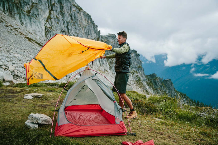
Our Bryce 1P backpacking tent is lightweight and weatherproof, helping you save on pack weight for this strenuous hike.
Trips during the early season may require some difficult stream crossings. Appropriate footwear, such as sandals or water shoes, is recommended. A pair of trekking poles could be invaluable during the crossings.
There are bears in the area, so practice bear safety at all times. A bear-proof food storage container is also required.
If there's anything else you need to complete your pack, visit our full line of high-quality, affordable backpacking gear.
Shop Backpacking Tents
Shop Ultralight Tarps
Shop Backpacking Quilts
Shop Down Sleeping Bags
Shop Insulated Sleeping Pads
Shop Backpacking Pillow
Shop Folding Trekking Poles
Shop Titanium Cookware
Shop Tent and Tarp Accessories
Finally, to make sure you don't forget something at home, use our Ultimate Backpacker's Packing List. It even includes a convenient printable checklist!
Do I Need a Permit?
Permits are needed for all overnight trips in the designated permit zones. Review this White River National Forest page for more information.
Resources
Here are a few great resources to check out for more detail:
US Forest Service Information
Transportation Information from the Aspen Chamber
Four Pass Loop - Trail Description at Hiking & Walking
Four Pass Loop Write-up at Backpackers-Review
Conclusion
Have you conquered the four passes along this loop? Do you have other outstanding hikes that you'd like us to write about? Please share your feedback in the comments.
Read Next
If you're looking for more hike ideas, read our “Best Backpacking Trips in the Rocky Mountains” round-up post. Also, the following Hike of the Week articles cover other great trails in the region.
Hike of the Week: Canyonlands: Needles District
Hike of the Week: Teton Crest Trail
Hike of the Week: Titcomb Basin
For even more amazing backpacking trips, visit The Trailhead, our interactive hike map. It contains a curated list of dozens of hikes, each with a detailed write-up like this one.

Finally, check out our comprehensive list of backpacking articles that cover just about everything there is to know about backpacking. If you're just starting out, our Backpacking 101 section covers all the basics. If you already have a few trips under your belt, you can find more advanced topics covered in our Expert Articles.


I have hiked the loop 3 times. I plan to go back summer of 2021. Any takers?
Im thinking of hiking it in the fall. Whats the earliest snow anyone has run into?
I plan on doing this trail in Late June. My only concern is snow and if the passes are passable that time of year?
Early June could be a challenge. I’d keep an eye out on the amount of snow that falls in the spring. Colorado can get hammered with snow in February and March, so it’s hard to say. If you can push the hike to late June, I think you odds of a successful trip will be better.
If you do decide to go, check for trip reports on www.14ers.com and other sites to see how the conditions are. Plan to bring a GPS or smartphone navigation app with the trail mapped so you can make sure to stay on it. Also, you’ll probably need a 15-20 degree bag for that time of year, since it could still be very cold at night.
Any advice on hiking in early June? I’m mostly concerned about traversing snow on the passes and/or losing the trail.
Leave a comment