
Welcome to Paria's “Hike of the Week” series. For us, reading about a great hike motivates us to want to do it ourselves. We hope this series inspires you to do the same!
This week's highlight is on the Grafton Notch Loop in Maine.
Featured photo: Old Speck (photo by Chris Rycroft)
Why This Hike?
Not quite ready to tackle Maine's infamous 100-Mile Wilderness? The Grafton Notch Loop provides a challenge while still having bail-out options. Plus, you can't beat the views! When you're not traipsing through the forest, you'll find awesome views of the Mahoosuc Range. You'll even be able to see the Presidential Range in nearby New Hampshire.
- Distance: 39 miles
- Type: Loop
- Difficulty: Strenuous
- Elevation gain: 11,000 feet
- Best time: April-October
- There are 8 designated campsites altogether, split evenly between the west and east sections. There is also the Baldpate lean-to on the AT section.
- There are water sources at each campsite.
- You'll travel over 8 summits, including Maine's third-highest point.
- Highlights: Baldpate Mountain, Sunday River White Cap, Old Spec Mountain (observation tower), and Puzzle Mountain.
- Wildlife includes moose, black bears, and gray jays.
- Add on some of the side trails to extend your adventure.
- Plan on taking between 3 and 5 days.
Before you pack your bags, keep the following in mind:
- Fires are only allowed in rings at designated sites. They're not allowed at all on the private land sections.
- On top of the rough terrain, you can also expect some ladders, stairs, and slippery exposed rocks.
- Snow can hang around in the higher elevations. Don't be surprised by mud and biting bugs in the early season.
How Do I Get There?
Portland International is the closest major airport. From there, turn left onto Jetport Blvd. Turn left to merge onto I-95 N. Continue 16.5 miles. Take exit 63 for US-202. Use the middle lane to turn left onto ME-115 W. Turn right onto ME-26A N. Continue a little over 23 miles. After a few jogs through South Paris, keep on ME-26 N for 23 miles. Turn right onto Parkway Rd briefly before turning right onto US-2 E. After 5.5 miles, turn left onto ME-26 N again. After about 5 miles, the parking area will be on the right. The total drive time is about 1 hour and 40 minutes.
Map of Recommended Route
The following map outlines our recommended route. Click the "Load Interactive Map" button to load the correct map. Once loaded, you can navigate along the route and view recommended campsites.
For even more detailed mapping, including being able to print a copy for yourself, click the "Open in CalTopo" button at the top of the map once it's loaded into view.
Here are our recommended campsites:
- Day 1 - Southern Trailhead to Slide Mountain Campsite (11 miles)
- Day 2 - Slide Campsite to Bald Col Campsite (11 miles)
- Day 3 - Bald Col Campsite to Stewart Campsite (13 miles)
- Day 4 - Stewart Campsite to Parking Area (4.5 miles)
Trail Description
Day 1 - Southern Trailhead to Slide Mountain Campsite
Start with a short road walk south to the trailhead. From there, you'll walk across an open field before getting to the woods. Shortly, you'll cross the Bear River. Bald Mountain Campsite will let you know you're getting close to its namesake. A few miles after that is Stowe Mountain. Then, you'll head north for a bit and pass the Sargent Brook Campsite.
Continuing north, you'll summit Sunday River Whitecap next. This might be a good place for a break. There are great views of Old River and Mount Washington in the distance. The ups and downs aren't too bad the rest of the way to Slide Mountain Campsite.
Day 2 - Slide Mountain Campsite to Bald Col Campsite
Your second day takes you up and up towards Speck Mountain. This is another excellent place to take a break. Be sure to check out the observation tower. After a few miles, you'll walk along the top of a ridge for a bit. Then, you'll head back down toward ME-26 again. Shortly past there, you'll cross the Bear River again. If you're feeling tired, you can spend the night at the Baldpate Lean-to. Or, you can go ahead and start Baldpate Mountain. Bald Col Campsite is on the other side of the west peak.
Day 3 - Bald Col Campsite to Stewart Campsite
Straight away you'll head up Baldpate Mountain proper. You'll follow a ridgeline for a while before heading down and south. Pass two more campsites and Wight Brook. Fill up now if you need to! It's also a nice creek to cool off in during the summer. One more campsite comes up before climbing Long Mountain. Enjoy some downhill hiking for a while. Then, head back up to Stewart Campsite and enjoy your last night on the trail.
Day 4 - Stewart Campsite to Parking Area
Your last day starts with its biggest hurdle: Puzzle Mountain. Past here, there are several more lookouts. Your journey is almost over, so enjoy the views of the Bear River Valley and the Presidential Range in the background. The last few miles of any trip always feel the worst!
What Will I Need?
Temperatures get pretty warm on summer days. Expect 70s and 80s. Nighttime is comfortable in the 50s, but still humid. A down quilt works well for this trip. That way if you do get too hot you can always stick your feet out. A quality sleeping pad will also add to your comfort. With all of the ups and downs, you'll probably be tuckered out at the end of the day. This tiny air pump/lantern will save you some work on set-up. Plan on taking a lightweight backpacking tent to lighten your pack weight.
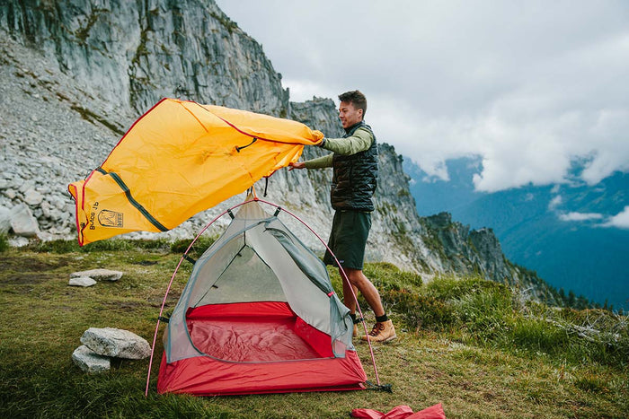
Our Bryce 1P backpacking tent is lightweight and weatherproof, making it a great option for the rainy Grafton Notch Loop.
Maine gets quite a bit of rain. It's a good idea to store your stuff in waterproof stuff sacks. You might want some trekking poles to aid in the elevation changes. Again, there are water sources at every campsite. You'll still need to filter it, so don't forget one and a backup source! You'll need to replenish all those calories you burnt. A compact backpacking stove and titanium cooking pot will take up little space in your pack.
If there's anything else you need to complete your pack, visit our full line of high-quality, affordable backpacking gear.
Shop Backpacking Tents
Shop Ultralight Tarps
Shop Backpacking Quilts
Shop Down Sleeping Bags
Shop Insulated Sleeping Pads
Shop Backpacking Pillow
Shop Folding Trekking Poles
Shop Titanium Cookware
Shop Tent and Tarp Accessories
Finally, to make sure you don't forget something at home, use our Ultimate Backpacker's Packing List. It even includes a convenient printable checklist!
Do I Need a Permit?
You do not need a permit.
Resources
Conclusion
Have you hiked the Grafton Notch Loop? We'd love to hear about your trip in the comments section below! Or, let us know what other trails are worth visiting in Maine.
Read Next
If you're looking for more hike ideas, read our “Best Backpacking Trips in the Eastern U.S.” round-up post. Also, the following Hike of the Week articles cover other great trails in the region.
Hike of the Week: 100 Mile Wilderness
Hike of the Week: Presidential Range Traverse
Hike of the Week: Pemi Loop Trail
For even more amazing backpacking trips, visit The Trailhead, our interactive hike map. It contains a curated list of dozens of hikes, each with a detailed write-up like this one.

Finally, check out our comprehensive list of backpacking articles that cover just about everything there is to know about backpacking. If you're just starting out, our Backpacking 101 section covers all the basics. If you already have a few trips under your belt, you can find more advanced topics covered in our Expert Articles.


Leave a comment